This article is also available in PDF format.
|
an amazing megalithic
center Numbers in the text refer to notes, click on the
numbers to go the respective note and use back button to return to article. Megalithic sites are a mystery for archeologists.
They were originally thought to have been built by primitive cave people
with stone tools for the purpose of bloody rituals. Well, this reflects
more the state of mind of the archeologists than what megalithic sites are
about. The more we study them the more we find that they are much older
than we thought, and that they have been built by a people with a high level
of astronomical knowledge and a sophisticated technology. One of those sites
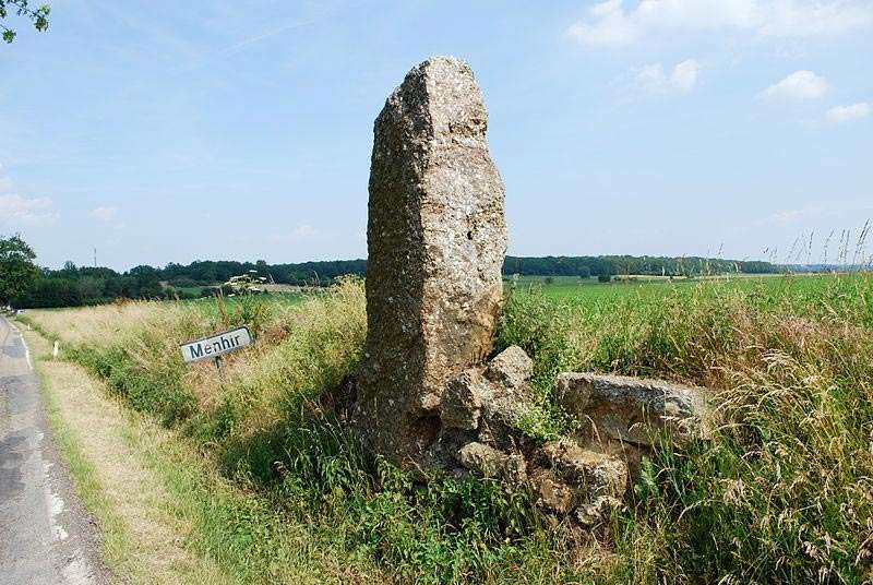
is Wéris in Belgium. The White Menhir |
|
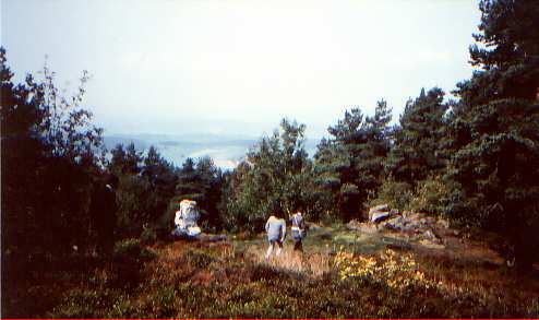
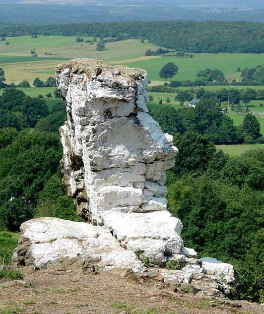
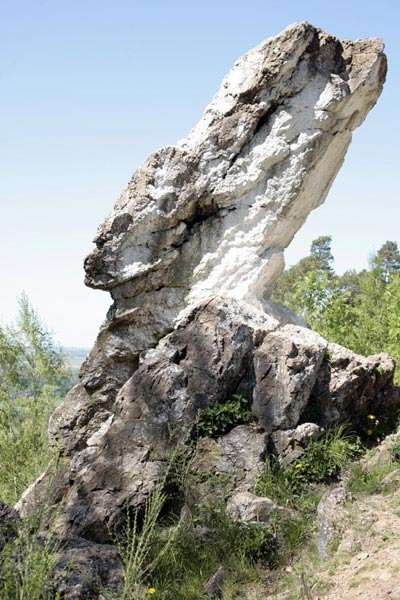
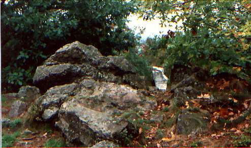
Central to the Megaliths at Wéris is the "White
Menhir" which is… not a menhir at all. On one of my visits I found
a broom and a load of beer bottles that had been left behind (see picture
on the left), having arrived the day after the yearly local tradition of
painting this "menhir" with white chalk. The White Menhir is on
top of a small, rocky hill. Nowadays it is surrounded by trees, but once
it must have been visible for miles. The White Menhir is a piece of rock,
3 meters high, 1 meter wide and has an inclination of 45° pointing to the
East. The local population still calls it with the ancient name "Pierre
Haina", meaning "Stone of the Ancients" in both Celtic and
Breton. There are a couple of strange things with this apparently natural
rock formation. The stone was not placed on top of the hill. No, the top
of the hill was chiseled away leaving an outcrop that became the White Menhir.
Who would go to such a lengths to sculpture a hill top?
(1) |
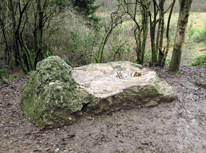
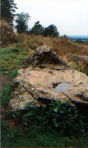
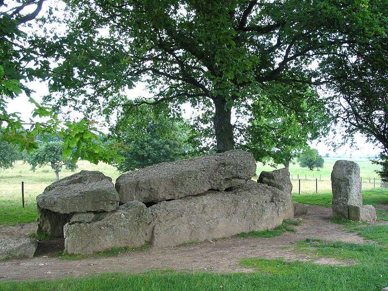
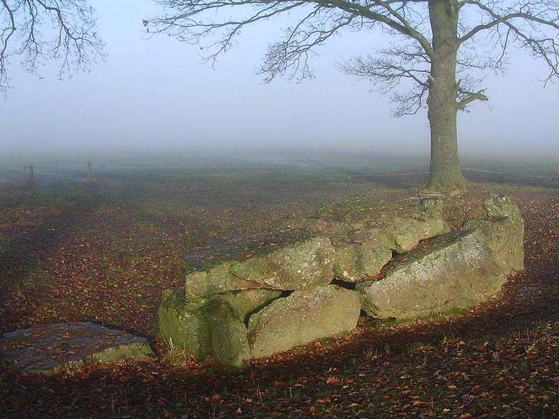
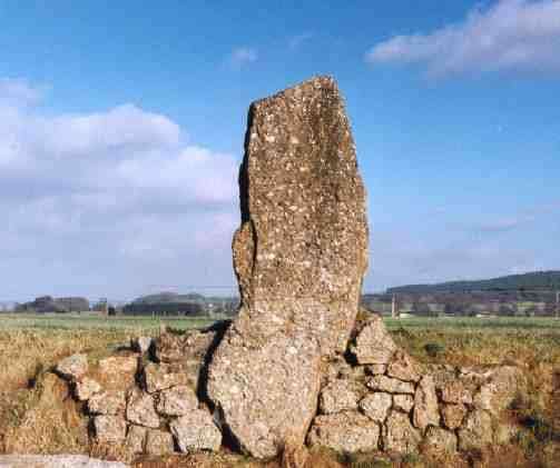
| The Devil's Bed at the foot of the hill.
Notice the smoothness of the horizontal stone. It is 2.45 m long, 1.45 m
wide and 0.6 m high. I think it is possible that this rock has been
vitrified. Vitrified rock from ancient cultures has been foud all over
the world. It is still a mystery how they did this. There is another
very smooth stone at the Southern Dolmen (see below). |
|
What do we make of a sculpted hill top, a mysterious being that flies around and a tunnel that leads to an underground realm? Although I didn’t feel anything special at the White Menhir itself, one day at the Devil’s Bed I got quite dizzy, I almost felt drunk. The woman who was with me, experienced the same thing but she had felt it at the White Menhir too. The earth's energies were probably at a peak that time.
While on top of the hill, I walked away from the
White Menhir, crossed the "Castle" (more about this will follow;
in the picture above, the 'castle is the rock formation on the right)),
and went a couple of steps down the hill. There I discovered a small depression
in the rock. It was round, about three feet in diameter, one feet deep,
and it was filled up with dirt. It looked man-made. I had not read about
this feature and I think it still unknown to other people. I was strangely
attracted to it. I was psyching it out and finally stepped into it to have
a better feel. I felt that at one point in time it used to be a vertical
air shaft to an underground realm. It had been closed of long time ago,
and was now functioning as an energy shaft. A certain type of energy was
being drawn inside. After only half a minute I just couldn’t stand there
anymore, I had to get out of it. I had the strong impression that the beings
in that underground realm did not want anybody blocking the energy flow.
Those beings were of the gnome type, that is Little People. There are different
types of Little People and I can’t tell you what type is living there. So
I left it for what it was and strolled around a bit more, while my friend
was doing the same. We always would scout around by ourselves to see what
we could find. We would not talk to each other or interfere with each other
until we were done. When we came back together she had found the feature
and had the same impressions about it. It was a surprise to me to come up
with this information, as I had not paid much attention to the legend.
(2) |
|
This is the front of the Castle, the White Menhir is behind your back. At the point of the arrow is V-shape indentation in the rock, and behind it is the depression in which a man can lie down. |
|
Now we are at the other side, on top of the Castle, lying down in the depression looking through the V-shaped sight, looking at the top of the White Menhir. |
|
If you imagine the trees
not being there, and you lie in the depression, looking through the v-shape
cutout, with the top of the White Menhir in sight, then you will see, in
a straight line, the "Allée Couverte Nord", a well-known dolmen
about 1500 m (about 450 feet) further down in a field. The ancients just
loved to line up those sites. This is just the beginning! From the V-shaped
sight one looks to the geographic West, this is the point of sun set at
the equinox, when night and day are equally long (around 22 March and 22
September). (Equinox line in dark red on map below). What started out as
a strange rock formation now turns out to be an astronomical observation
post. (3) At the foot of the hill is the
Devil’s Bed! A word about the Devil’s Bed. The horizontal stone is polished
smooth, very smooth. Although the surface is uneven, something polished
the top surface of that stone so smooth that you can run your hand over
if without scraping your skin. I found one other stone like this as part
of the "Allée Couverte Sud", a dolmen a little further down the
fields. There are more megalithic sites on this solstice line: a devil’s
stone in Poilvache, a "Zeupire" stone in Gozee and a dolmen in
Bellignies. Whoever planted those stones had not only a great astronomical
knowledge but was able to project their knowledge onto a wide landscape. The North Dolmen
|
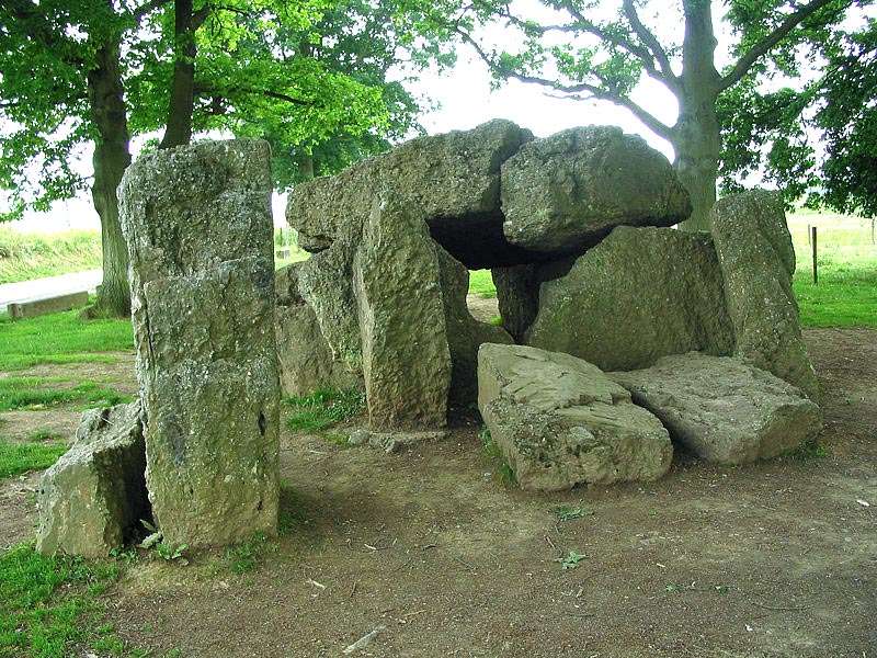
This is the back
of the North Dolmen:
side view:
|
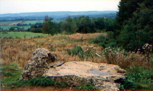
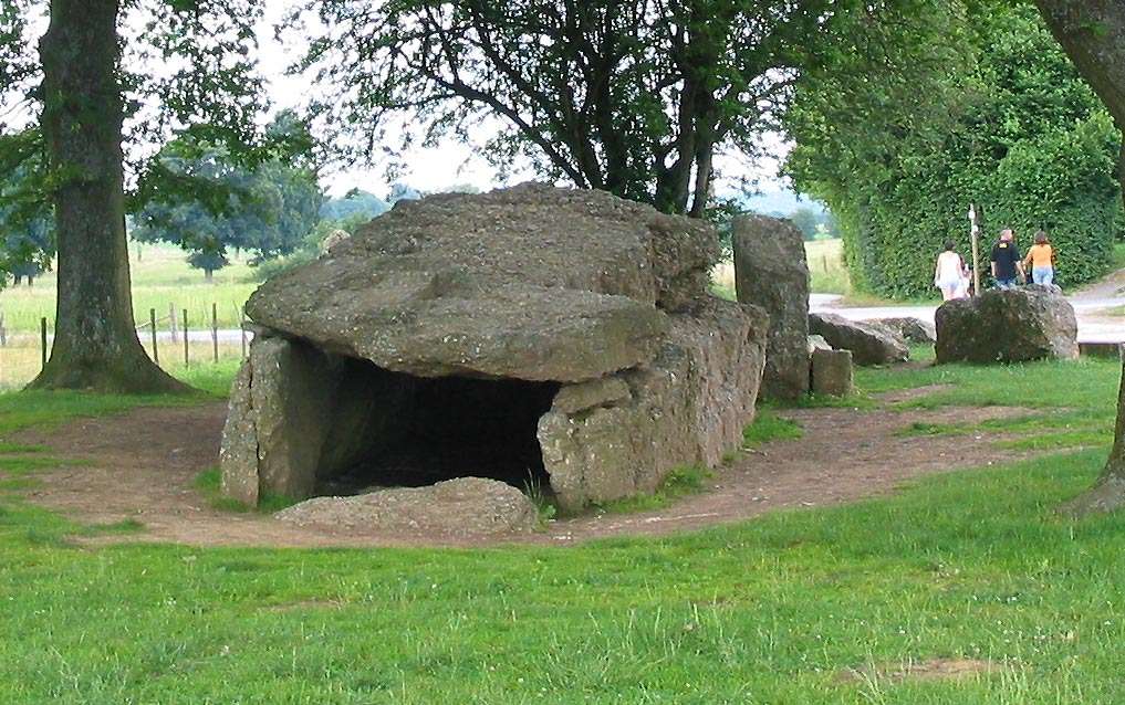
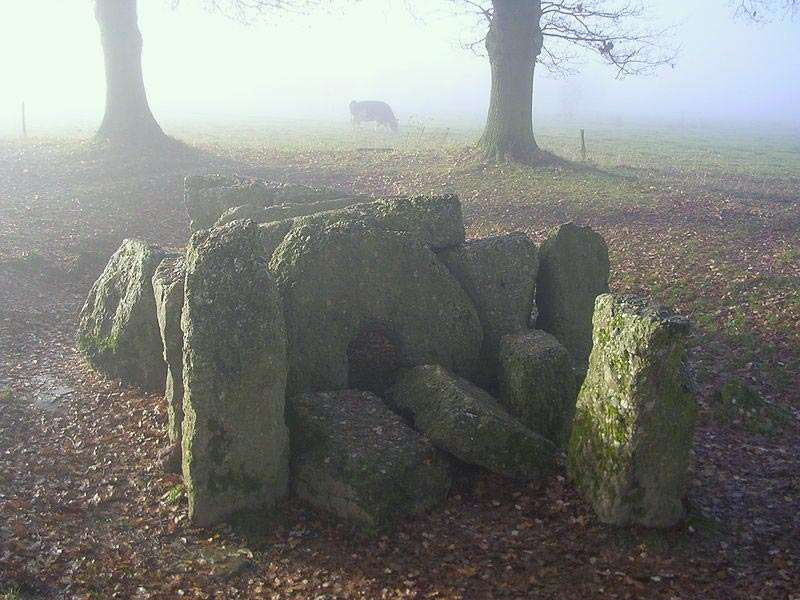
The South Dolmen Then in 1888 a second equally impressive dolmen was found, "Allée Couverte South", not in the bushes, it was dug out! It became obvious that this one had intentionally been covered with dirt a couple of centuries ago. In 1888 it was accidentally discovered when ploughing a field. It consists of 20 big stones. The dolmen is not in good shape anymore as it has collapsed. |
|
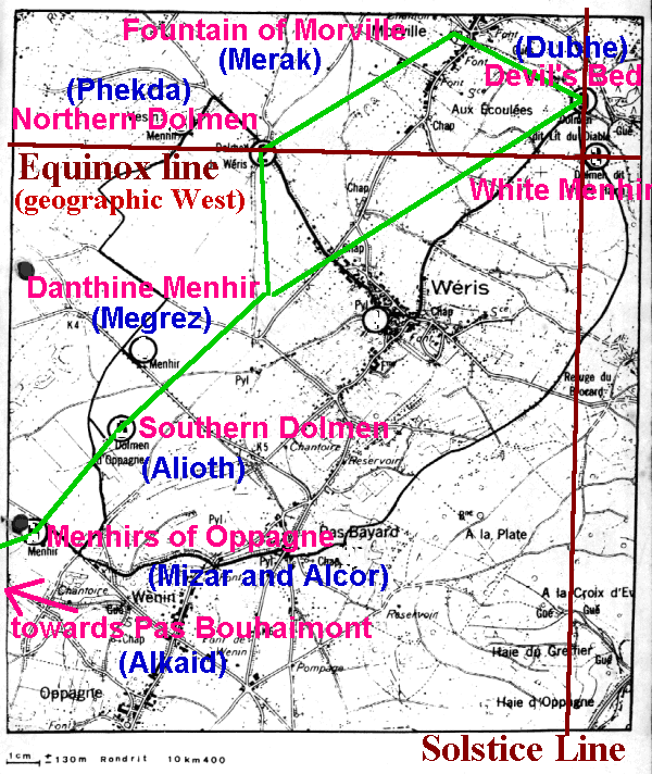
The Southern Dolmen and the Devil's Bed both are on the solstitium line, as are the Menhirs of Oppagne with the White Menhir. (Yellow lines on map below) |
The front stone has a half circular entrance:
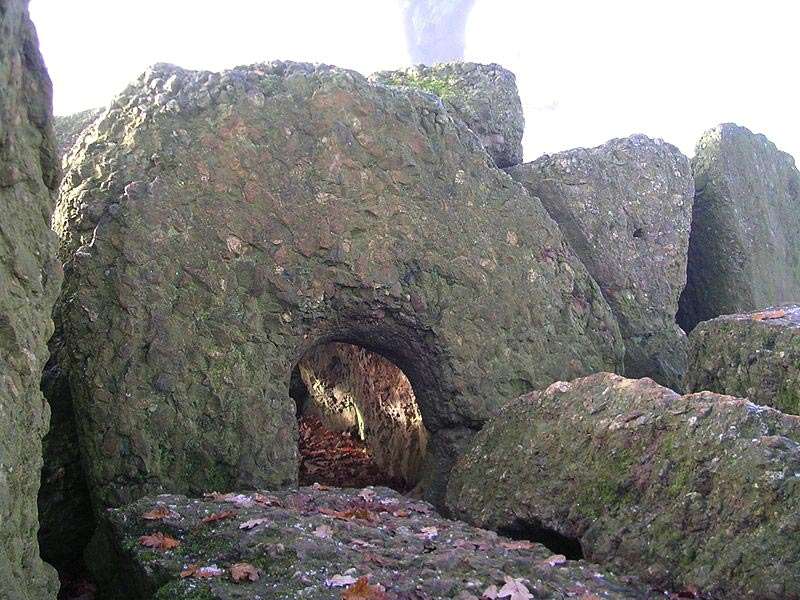
|
Side view of the South Dolmen. Circular entrance is to the right. Notice that at the left side, at the back end of the dolmen, is a large flat, smooth stone: |
|
Similar to the Devil's Bed, the top surface of this
stone has been polished extremely flat and smooth. The stone out of which
all the megaliths in Wéris are made is a conglomerate rock, pudding-stone,
and extremely hard (Pudding-stone is composed of little stones, sandstone,
limestone, quarts and flint). |
|
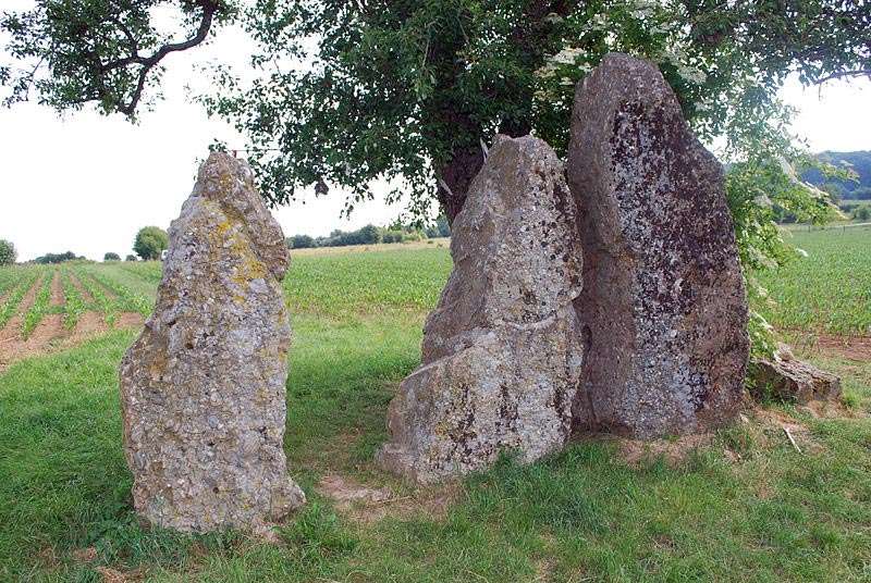
In 1906 three menhirs were found, also covered
with dirt, in the nearby village of Oppagne. When they were found they were
lying down, in pieces, next to each other and covered with dirt. Their location
is not exact anymore as they were once transported to a park, but returned
afterwards.
Then a dog began to dig several feet from the "Allée Couverte Sud" (Southern Dolmen). Just nest to this Southern Dolmen were three dolmens who had been intentionally toppled and covered with dirt. At the time I visited this place they were partially excavated. One wonders why all those megalithic stones were intentionally covered with dirt. The solution probably lies in the arrival of Christianity. When the Catholic Church moved northwards to impose their religious doctrines upon the "heathen", it often demonized and destroyed the old religion. In reaction to this, the local population hid their knowledge, and in the case of the megalithic stones, the only choice was to cover them with dirt so the Church would not even suspect the existence thereof. At the famous site of Avebury, Southern England, some of the stones were also found buried. As a skeleton was found underneath one of the huge slabs (the stone had fallen unexpectedly on one of the people), it was possible to date the event to the 14-15th century. The Danthine Menhir |
|
In 1947 a farmer plowed up another menhir, 3.6 m high and 8 tons. Ms. Danthine of the University of Leuven pulled it away and set it up along the road with a sign "Menhir". It is called the Danthine Menhir.
So, what do we have up to now: an astronomical observation post, the equinox and solstice line, and a number a megalithic sites in the fields which archeologists think were used for human sacrifices and bloody rituals. After all they had found human remains buried in or next to the dolmens. Archeologists, like so many other scientists, first come up with a theory and then proclaim this to be the truth. Whatever doesn't fit their theory is discarded. It has become well established that almost all the megalithic sites in Europe have astronomical alignments, this reflects a sophisticated knowledge of astronomy.(5) According to archeologists these monuments were build 5000 to 8000 years ago when man (in Europe) was but a primitive creature with only stone or copper tools. He sure had other things to do than schlepping tons of stones around. Could it not be that the megalithic monuments were much older, and had been built by a more developed and knowledgeable society that had perished? Later on, other cultures had found the stones, and buried some of their people at those sacred sites. You see, the stones themselves can not be radio-carbon dated, therefore we do not know how old the megaliths are. The dating is done on the human remains found on the sites, and archeologists thought they were the creators of the megaliths. More evidence for an older culture, at least 12000 years ago, is being found continuously all over the planet. The latest great find is a big stone pyramid, amidst a large city under water, off the coast of a Japanese island. (In the waters around Okinawa and beyond to the small island of Yonaguni.) This find has sent a shock wave through archeological circles, since the stone pyramid has to date from a time when the sea level was lower than the level on which the pyramid stands. Scientific records of the sea level show that this must have been more than 12000 years ago. (6) The Constellation of the Great Bear |
|
Is it than a surprise then, that when we put the megalithic sites of Wéris on a map, we find that they form the constellation of the Great Bear (the Great Wagon, the Big Dipper, Ursa Major)? The Great Wagon consists of seven stars, of which four form the wagon and three the shaft or the horse. The ancients were very meticulous about representing this constellation in the fields of Wéris. The center star in the shaft (or horse part) is Epsilon, Ursae Majoris, also called Alioth. It has a small companion star, Zeta, Ursae Majoris, which is hardly visible. The Arabs called it Saidak, what means "the test", because they used it to see if your eyes were sharp enough to distinguish it from Alioth. The megalithic site corresponding to Alioth is the three menhirs of Oppagne. Actually there are only two menhirs, because one of them is broken in two. The tall menhir is Alioth, the small menhir is Saidak. For two stars in the constellation of the Great Wagon the megaliths are missing. At the place of the star of Merak is a fountain, but perhaps the stone is still buried there. At the place of Al Kaid is a rock with a hole in it, which the locals call "Pas Bouhaimont", or "Step of the Ox of Haimon". Haimon, in the local legends, was a leader and Al Kaid in Arabian means leader or guide. Al Kaid is the star at the top of the shaft or horse, guiding us to the next constellation, Bootes the Herdsman.
Most of the megaliths are placed in a row over a distance of 2400 feet (7400 meters). When we also take into account the originals sites of those stones that have been removed by man, we see that those megaliths form five parallel lines which run from south-south east to north-worth east in a 26.5 degree angle from geographic north. 26.5 degrees is exactly half of 53 degrees, which is the angle of the solstice lines with geographic north and south.
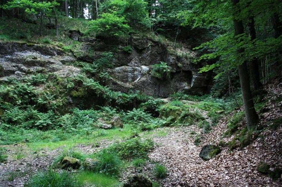
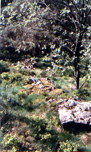
The Quarry where the megalithic stones came from The ancient quarry were all the Wéris megaliths were cut:
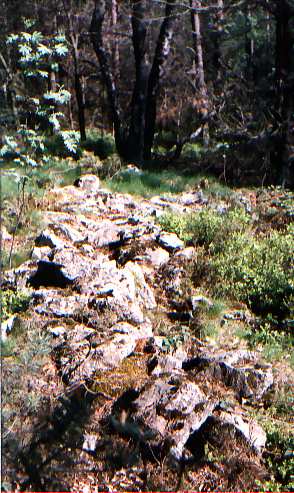
Where did the creators of those megalithic sites get the stones? In Wéris, hidden in the woods, is the old quarry from which the stones were cut and transported. It is one of my favorite spots in Wéris. Many thousands of years ago the ancients cut blocks of stone in all shapes and forms, of many tons each, and transported them down the hill. In a diameter of a kilometer or two (one or two miles) there are still hundreds of finished and unfinished megaliths strewn around. It looks like the builders suddenly stopped the work and left. What could have happened? It must have been a great catastrophe to force them to stop working overnight. Wéris is not alone in this regard. All over the world we find evidence that the ancients suddenly stopped what they were building, leaving their work unfinished. It suggests a world wide catastrophe that ended a well organized, highly advanced and knowledgeable culture. I thought long about who the megalithic builders were and I have come to the conclusion that the megaliths must have been built in the latter days of Atlantis, before its destruction in 10,000 BC.
Perhaps the megalithic sites were all built by the same people, a class of megalithic masons so to speak. After all, wherever you go the ancient sites are all characterized by great astronomical, architectural knowledge that is way beyond the knowledge of common man. They also must have had sophisticated tools to project their astronomical knowledge onto the surface of the planet. There is also the question of how twenty or more tons of stone blocks were transported, sometimes over many miles. Legends tell that Stonehenge was built with stones that were levitated by magic from large distances. The Incas claim that the ancients built cyclopean buildings with a technology of sound. It appears that the Atlanteans were able to cut stones with something that might resemble microwaves, and were able to temporarily annihilate gravity to move the cut stones. |
Stone Serpents
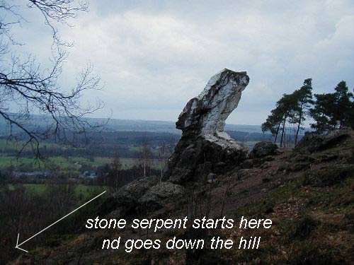
|
There is more! When you talk about megalithic sites you talk about energy. Many of those sites were built on energy spots of the earth, ley lines. The subtle energy of the earth was diverted to the sites. On many sites you still can feel the energy pulsing through, although the earth’s energy waxes and wanes. I was able to get a copy of a brochure made by a self-made druid living near Wéris. He is also a clairvoyant and sensitive to subtle energies. He spent a lot of time with the megalithic stones in Wéris, and was sometimes guided by ancient spirit beings still residing at those spots. He pointed out an overlooked feature, which he calls the snakes. These are small stone walls composed of loose rocks that wind through the landscape and connect different stone structures. They seem to start from the highest point in the landscape, the White Menhir. From the White Menhir a stone serpent goes down the hill and leads to a stone circle, but also branches off to other megalithic structures nearby. |
|
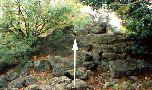
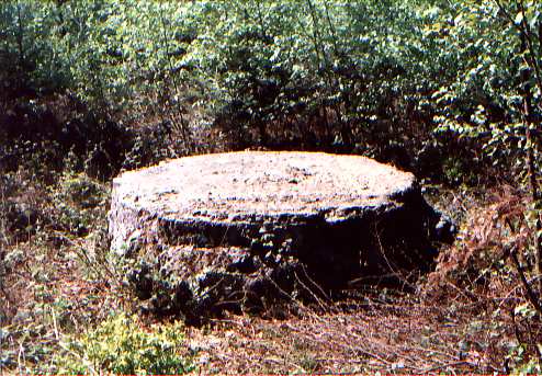
The pictures above are of one of those stone serpents. Nowadays the network is incomplete as roads, houses, yards and so on have cut through and sometimes removed these stone serpents. One might easily mistake them for property borders, but the fact that they only run to megalithic sites tells us otherwise. This druid claims that the White Menhir had an additional function of attracting energy from lightning and the stone serpents would guide this energy to the megalithic sites to charge them up. Now here is an interesting thought. He also found additional dolmens, some still in good shape, hidden in the woods. He doesn’t want to make them public in order to protect them from vandalism and misuse. I found two of them, well hidden behind dense foliage. Very nice, it was obvious that someone was doing rituals at these spots. I went to the back of the White Menhir, where the top of the hill suddenly drops off. I followed one of the stone serpents from the base of the White Menhir all the way to a small, forgotten, stone circle. A couple of stones were missing, and more than half had fallen down over time. A little distance from here, also in the woods, I stumbled upon an amazing structure: a massive stone, almost cubic in shape. Right angles, flat sides, and as far as I remember, at least 10 feet (3 meters) wide, high and deep. It was obviously an artificial object, and sitting in the middle of the woods, in a flat area. One wonders what it is doing there, why it was cut that way and what purpose it must have had. Or was it one of those unfinished pieces left behind? It must weigh many, many tons. |
|
The druid I mentioned before also tells of a hill
ridge he found next to the hill where the White Menhir is. The hill ridge
is overgrown with trees and shrubs. It is not always easy to find the megalithic
sites up there, some of them are in disarray, others are clearly man made
but not of a clearly defined structure. With his psychic abilities and his
contact with the local spiritual beings he came to the conclusion that this
hill ridge, together with the White Menhir, represents and emanates energies
corresponding to the seven chakras. The White Menhir represents the lowest,
or base chakra, at the lower end of the spine, where also the genitals are.
Does the White Menhir, with his inclination of 45° , not look like a gigantic
penis? I had a look on the hill ridge, it was a difficult climb and walk
on the top. There were definitely some strange structures, but it was difficult
to tell what they actually were, although I found on the hillside a small
dolmen.
|